On the basis of actual requirements of real-time deformation monitoring of landslide disaster and KQ GEO’s experience in GNSS technology applications, GNSS High-Accuracy Landslide Monitoring and Early Warning System makes full use of Continuous Deformation Monitoring System created by high-accuracy real-time kinematic positioning technology, modern computer technology, digital communication technology and Internet technology. It is a high efficient solution integrated with GNSS data collection, data transmission, data processing and analysis, early warning release and system management.
GNSS High-Accuracy Landslide Monitoring and Early Warning Systems consisted of six subsystems:
1. Data Collection Subsystem
2. Data Communication Subsystem;
3. Data Analysis and Processing Subsystem;
4. Display and Early Warning Subsystem;
5. Real-Time Deformation Monitoring and Management Center;
6. Operation and Maintenance Services Subsystem.
Among them, Real-time Deformation Monitoring and Management Center is the center of the whole system.Data Analysis and Processing Subsystem is the real-time GNSS data analysis center, which is the core of the system.
 System Feature:
1. All-weather Real-time Monitoring
System Feature:
1. All-weather Real-time Monitoring
Different from the traditional monitoring method, this system is not affected by climate, and it conducts 3D high-accuracy monitoring in 24 hours.
2. High- accuracy
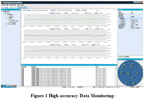
Adopting advanced high-accuracy GNSS real-time kinematic positioning technology and related algorithms, the system operates dynamic 3D monitoring with precision reaching to ±3 mm(1δ), and daily monitoring precision to ±1 mm(1δ).
3. Intelligent Analysis, Early Warning
With reliable and stable data,different models are established for different applications, which can accurately reflect the real-time situation of monitoring points, and also carry out intelligent analysis of relevant data. Moreover, it can timely release classified warning information in various channels and forms, which provides solid technical support and information reference for scientific decision-making.
4. Distributive Structures
The system applies client-server distributive structures. After having set the server, users can install system software client in terminals (such as personal computers, mobile phones and other devices that support network communications) to connect to remote servers, so as to see the latest deformation info.
5. Flexible Selection
Under the premise of ensuring the monitoring function and precision performance, the system takes full account of the practical conditions of the project and the economy of the project investment, offers various types of selection schemes, and supports a variety of mainstream single frequency or dual frequency GNSS receivers, thus can maximally meet customers’ requirements.
 (8610)85271488


 GNSS High-Accuracy Landslide Monitoring and Early
  (8610)85271488
 Service Network
 Join Us
 current position: