With the key technologies such as Beidou satellite communication spare channel, high resolution remote sensing data and advanced computing models, the company created Mountain Flood Monitoring & Warning System, which supports both ARCGIS and KQGIS platforms, and achieves disaster early warning and analysis, fast assessment of disaster losses, real-time data update as well as statistics report analysis output and thematic maps production etc. The system combines virtual reality technology and 3D visualization technology to realize mountain flood monitoring & warning on the foundation of real scene of flood simulation. This is a comprehensive solution of supervision, early warning, analysis, query, emergency, feedback and statistics.
System Functions:
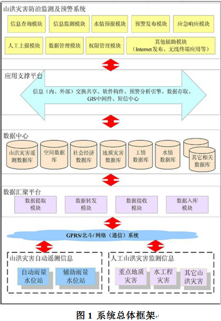
1. System Structure:
Mountain Flood Monitoring & Warning System includes:
 2. Features:
(1) Monitoring
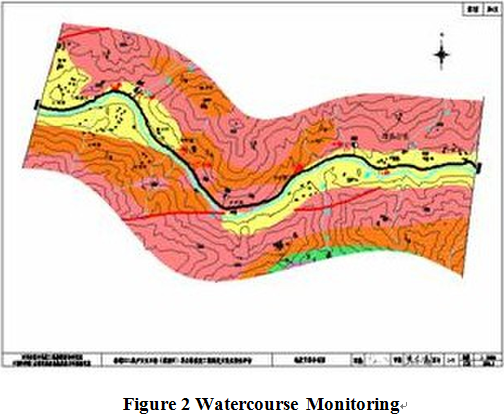
The system provides the services of real-time monitoring on mountain flood data. Monitoring objects: river channels, reservoirs, ponds, embankments and flood prone areas; monitoring items: water level, rainfall amount, water flow, videos, etc; monitoring methods: automatic collection, classified storage, display and transformation of manual data input and real-time data, providing an informational foundation for mountain flood early warning system.
 (2) Early Warning and Forecasting
Based on the materials of real-time rainfall amount, water level, water flow, weather, etc. and combined with self-developed technologies by KQ GEO, the system adopts advanced analysis models, achieves real-time online flood forecast. Meanwhile, in accordance with “Algorithm for Real-time Calibration”, it further corrects all parameters to grantee accuracy.
(3) Response
The system can automatically release early warning and evacuation information based on related regulations and pre-set warning models, and launch mass decision-making and prevention system to expand warning range and warning methods at the same time. Under the leadership of flood control headquarters at all levels, it plays an important role in disaster prevention, disaster management and disaster relief to reduce negative influences caused by flood.
(4) Consultation
Based on various kinds of warning and forecasting models as well as data from monitoring system, Consultation System offers feedback through forecasts, plans and models. The warning and forecasting models are consisted of domestic watershed runoff models, hydrology forecast models, flood evolution models, long-term weather forecast models, landslide, collapse and debris flow and other preview models of geological disasters. It operates monitoring and forecasting with deduction analyses such as multimedia technology and geographic information etc. Besides, it includes flood disaster prevention plan (plan of disaster shelter, relocation and transfer and emergency relief), and analysis models for related disaster evaluation).  (8610)85271488


 Mountain Flood Monitoring & Warning System
  (8610)85271488
 Service Network
 Join Us
 current position: