Based on various kinds of data got from water conservancy survey, KQ Water Conservancy Survey Query and Service Management is a comprehensive system managing water conservancy survey data. It offers querying and analyzing functions for survey outcomes by establishing KQ Water Conservancy Survey Query and Service Management. The system can satisfy needs for query and application services, making water conservancy survey more efficient.
 1.System Functions:
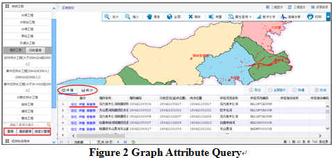
1) Basic Query
1.System Functions:
1) Basic Query
The system can conduct basic search, advanced search and spatial search for 6+2 census outcomes.
 2) Thematic Query
Advanced query functions for business such as flood control and drought relief, water administration & resources management as well as soil and water conservation etc.
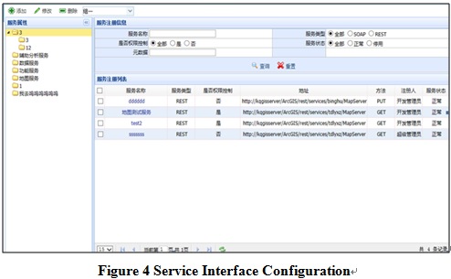
.png) 3) Service Publishing and Management
3) Service Publishing and Management
The system adopts national and industrial service interface to manage water conservancy survey data for the purpose of co-constructing and sharing of the entire water conservancy information. The system is also compatible with the third-party services.
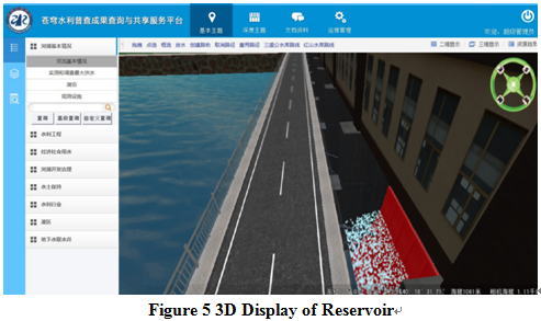
 4) 3D Scene Display
For facilities of the key water conservancy project, the system sets up 3D scenes based on the water data which provides realistic user experience.
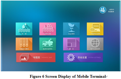
 5) Mobile Application
Customized and integrated services for special application in the mobile terminal.
 2. Features:
(1) Concept of “Cloud collaboration + Big data analysis”
2. Features:
(1) Concept of “Cloud collaboration + Big data analysis”
Utilization of Concept of “Cloud collaboration + Big data analysis”; comprehensive application of data warehouse, space-time dynamic database, metadata and mass data storage, etc.; structure based on service-oriented GIS concept with sustainability.
(2) Smart Water Resources Management Platform with the Whole Workflow
Industry demand drives platform data and functional module iteration; replicability of the platform.
(3) Power Management of Water Conservancy Data
Establishment on the basis of unified data model, unified basic data and unified data exchange standard; capacity of integrating third-party interface and form a comprehensive “One Map” database of water conservancy.
 (8610)85271488


 KQ Water Conservancy Survey Query and Service
  (8610)85271488
 Service Network
 Join Us
 current position: