KQ Information System of Urban Cadastral Management is chiefly used for regular urban cadastral management. To meet the requirements of cadastral management such as land registration, cadastral alteration, cadastral query, cadastral statistics, cadastral analysis and data report, the system standardizes the collection, processing, inspection, management and application of related registration data (including graphic data, attribute data and digital archives) of all kinds of land. It realizes the dynamic report of the timeliness and accuracy of business data and spatial data, and meanwhile links to the Real Estate registration information in order to build a system that can meet the actual application needs.
.png) System Functions:
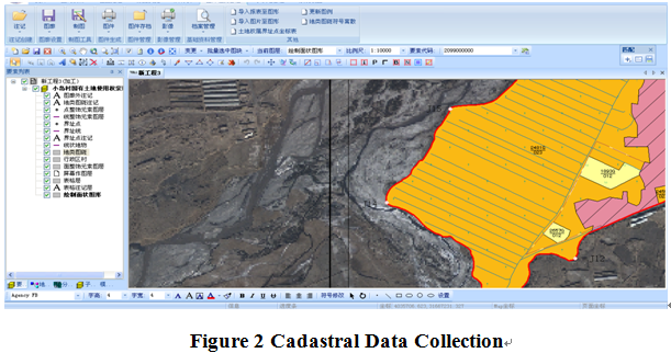
1.Cadastral Database Construction Subsystem
Cadastral Database Construction Subsystem mainly includes functions like data collection, data transformation, data inspection and processing, data storing and maintenance, data modification, and result output etc., to provide the management and operation of urban cadastral database.
System Functions:
1.Cadastral Database Construction Subsystem
Cadastral Database Construction Subsystem mainly includes functions like data collection, data transformation, data inspection and processing, data storing and maintenance, data modification, and result output etc., to provide the management and operation of urban cadastral database.
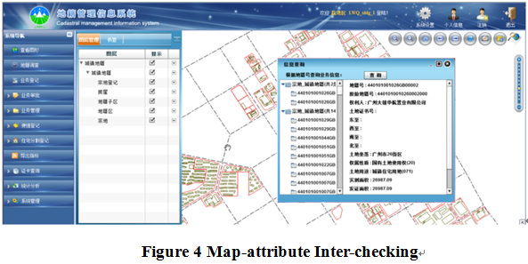
 2.Registration and Certificate Issuance Subsystem
Registration and Certificate Issuance Subsystem is mainly used for state-owned construction land tenure registration including all kinds of registrations such as general registration, initial registration, modification registration, cancellation of registration, and other registration etc.. Meanwhile, the system includes map data management to provide the services of graphics checking, graphics positioning, graphics-accompanied examination and approval, which is convenient for the users to check registered land parcel and realize the graph-accompanied examination and approval.
 (8610)85271488


 KQ Information System of Urban Cadastral
  (8610)85271488
 Service Network
 Join Us
 current position: