KQ Land Regulation Planning Management System, in accordance with the national standards of land regulation specialized planning, completes the data establishment of land regulation specialized planning, achieves the integration with standards and extends the database-built features of land utilization planning revision.
The system can directly conduct land regulation planning establishment, control and formulate land regulation plan in order to ensure the consistency and timeliness of data, so as to improve the farmland quality and increase available farmland area, and offer the users a good decision-making tool.
System Functions:
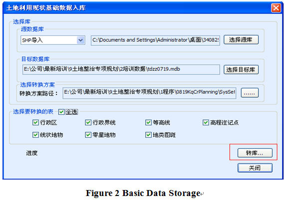
1.Base Data Management
Applicable for multi-format data storage management.
2.Index Management
Including total index management and village-town-separated index management.
3.Regulation Planning Data Establishment
Two kinds of regulation planning data establishment are provided: 1. block drawing; 2. block collection.
4.Project Pre-inspection Analysis
One-time analysis and checking towards attribute value and features of the entire database will be conducted. The faults will be listed and popped up and then will be automatically corrected by the system.
5.Project Result Export
The system can output planning report forms and maps.
 (8610)85271488


 KQ Land Regulation Planning Management System
 .png)
.png)
.png)
.png)
 (8610)85271488
 Service Network
 Join Us
 current position: